
Your Location
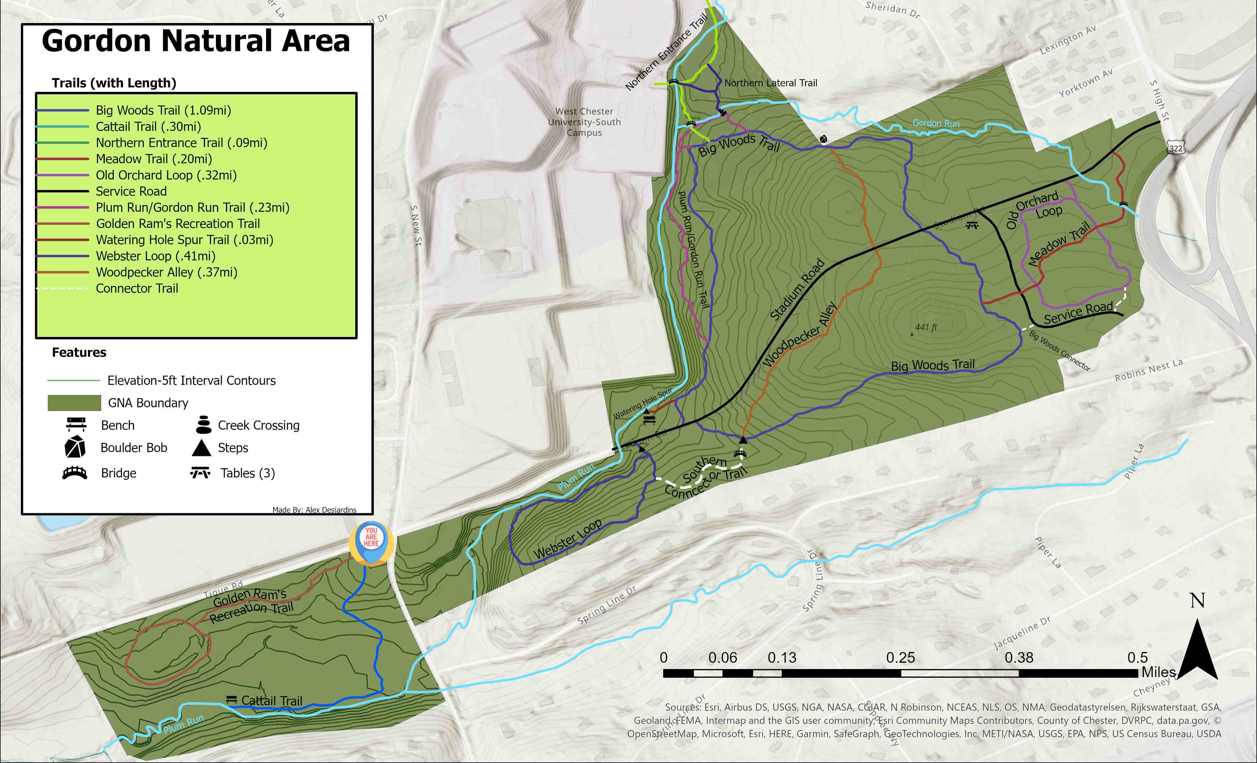
This Trail
Welcome to the start of the Cattail Trail! On this trail, you'll initially walk
downhill, passing through secondary forest and then through a Red Maple forest. The
trail then levels out and turns to the west, following a stream (Plum Run) while skirting
the southern edge of a large Cattail-dominated wetland. Both Plum Run and the Cattail
wetland support a wide range of bird species and the wetland also provides resources
for a rich insect fauna.
The Cattail Trail is 0.3 miles long and terminates at the channel that drains the wetland. You then have to turn around and go back the way you came (it's 0.3 miles back to the start of the trail).
In the future, we're planning to extend this trail (the first step will be to construct a bridge across the drainage channel).
Questions? Or, Need to Report an Issue?
Have a question to ask the GNA staff or something to report? Click here.